New digital map shows which community water systems have lead
–A new digital map that highlights which community water systems have reported the presence of lead pipes and fixtures is the latest legislatively-mandated action to target the health risks of lead in drinking water and set a timetable to replace the potentially hazardous hardware.
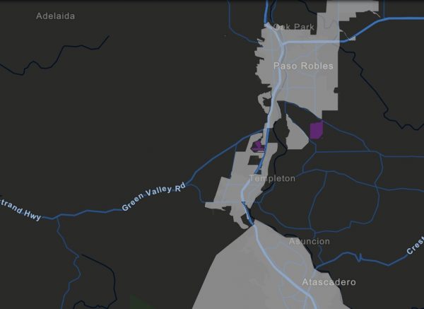
Released this week, the map uses State Water Board data from nearly 3,000 community water systems throughout California and places the information on an easy-to-read, color-coded document that is expected to change as testing continues statewide.
Community water systems were required by Senate Bill 427 to submit the results of a lead user service line inventory to the State Water Board’s Division of Drinking Water. The deadline was July 1, 2018.
A general overview of the first generation of the map shows plenty of good news – many water systems are entirely lead-free, indicated in gray – while also offering plenty of inconclusive information. In fact, upwards of 400 water systems have yet to provide enough complete data to provide an accurate picture of how much lead piping remains in the water supply infrastructure, indicated by large swaths of purple in many parts of the state map.
“The good news is that we only have four water systems that report having lead lines,” said Kurt Souza assistant deputy director for drinking water operations in Southern California. He added, another 31 water systems have lead fittings. “The State Water Board doesn’t anticipate seeing much more lead found”, said Kurt Souza, “based on the data reviewed so far.”
According to the new map, many of the lead pipes and fittings are in the San Francisco Bay area and Sacramento, much of it installed during World War II and shortly afterward. Lead pipes were banned in the 1980s.
California has been addressing the issue in a multitude of ways, including passing legislation requiring testing for lead in the drinking water at schools and, most recently, daycare facilities. The State Water Board is also awarding millions in grants for schools in economically disadvantaged areas to replace lead fixtures or offer alternative ways to access safe drinking water.
The data for the new map were collected in a 2017 electronic annual report. Those water systems with lead pipes and fixtures are required to provide the State Water Board with a schedule for replacement by July 1, 2020.
The online map is created in a such a way that any member of the public can click on a specific service area to open a pop-up window that provides inventory data. That way, viewers can glean information about the condition of pipes and fittings within their service area.
The law defines the lead hardware as anything that connects the main water line to individual water meters.
The map is divided into four categories:
1. Lead in the system
2. No lead in system
3. Unknown service lines or material
4. Incomplete information
Souza said the collected information included plenty of omissions, critical data fields left blank and errors, requiring State Water Board staff to spend months calling many water systems to confirm the data. Over 1000 water systems were considered incomplete following the first download of data. Details will continue to be filled in the coming months and the map will undergo updates to reflect changes.


