Cal Poly invites community to document king tides Saturday
King tides reveal future sea levels, says Cal Poly researcher
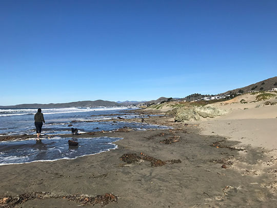
– Cal Poly invites the community to document this season’s king tides at events in Morro Bay and Avila Beach on Saturday, Nov. 16. The events, organized by Cal Poly’s civil and environmental engineering department and marine sciences program in partnership with California State Parks and the Central Coast Aquarium, aim to engage participants in climate change research and raise awareness about rising sea levels.
The Morro Bay event is scheduled from 9:20 to 10:30 a.m., with the peak tide expected between 9:45 and 10:05 a.m. Participants will meet at the Morro Bay Museum of Natural History parking lot on Morro Bay State Park Road.
At Avila Beach, the event will run from 8:30 to 9:30 a.m., with the peak tide around 9 a.m. Attendees will gather at Avila Beach Park, located at the corner of San Juan and Front Street.
Cal Poly students from civil, electrical, and mechanical engineering programs, who developed low-cost tide gauges to track coastal changes, will assist at the events. Installed along the San Luis Obispo County coastline, these gauges measure tides and waves, providing data to monitor ocean fluctuations and assess flood risks.
“By observing and documenting king tides, we’re essentially looking into the future,” said Serena Lee, a researcher in Cal Poly’s civil and environmental engineering department. “It’s a powerful visual that helps us understand what higher sea levels might mean for our local communities and environment.”
King tides occur when gravitational forces from the sun and moon align with Earth, causing ocean waters to reach their highest levels. While predictable, these tides highlight the effects of rising sea levels. State projections indicate sea levels along California’s coast could rise between 0.8 and 1.2 feet by 2050 and between 3.1 and 6.6 feet by 2100.
Community members can contribute photos of the king tides to the California King Tides Project, a citizen science initiative. Photos can be uploaded via a web browser or app and will appear on a map documenting this season’s tides. These images help scientists and planners prepare for coastal vulnerabilities.
“Even simple images of water on the coastline can provide us with so much information,” Lee said.
For more details, visit the California King Tides Project.